NDVI Time Series Analysis
Overview
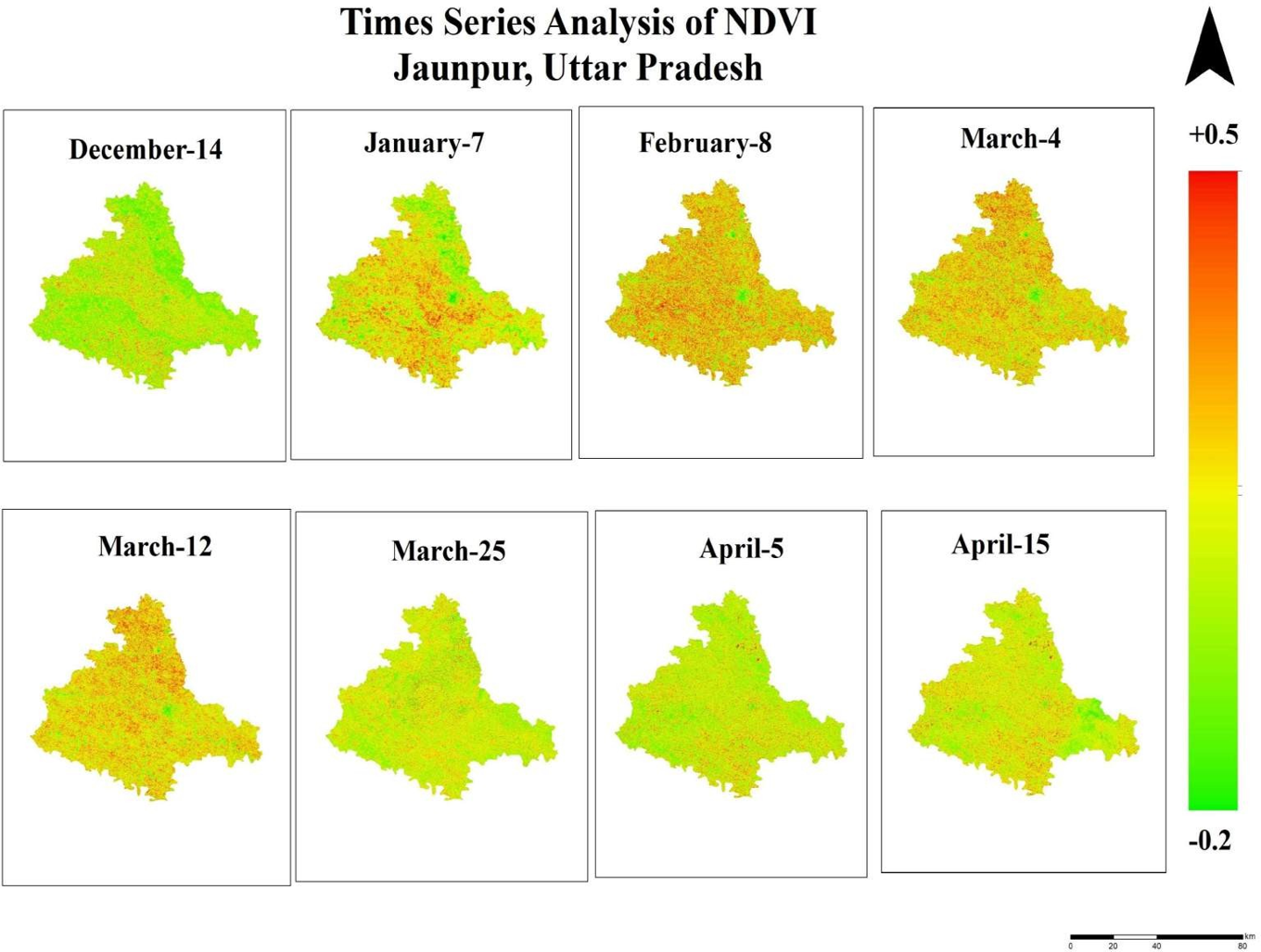
Performed temporal analysis of NDVI to monitor seasonal vegetation dynamics and assess crop growth patterns in Jaunpur district. Time-series satellite imagery was used to evaluate changes in vegetation health throughout the agricultural season.
Study Area: Jaunpur, Uttar Pradesh
Duration: Personal Learning Project (2026)
Role: Solo project
Status: Completed
Methods & Tools
Data Sources
- Sentinel-2 Imagery (Copernicus)
- Study Area Boundary (DivaGIS)
Tools Used
- Google Earth Engine
- ArcGIS Pro
Key Findings
- Monitored seasonal vegetation dynamics.
- Evaluated crop growth throughout the season.
- Identified healthy and stressed vegetation areas.