Regridding IMD Temperature Data Using Python
Overview
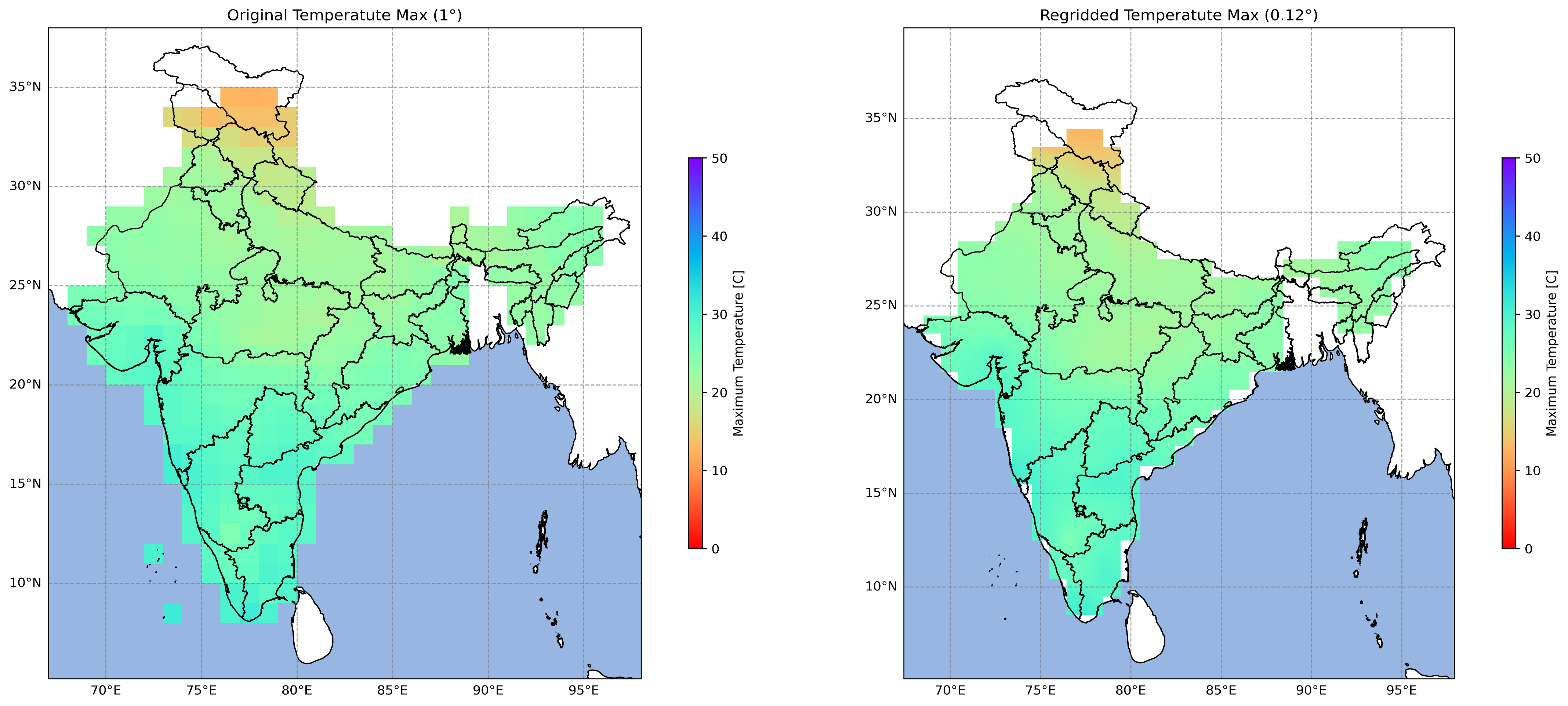
Implemented a spatial regridding workflow to convert coarse-resolution IMD temperature datasets into finer-resolution grids using Python. The enhanced datasets improve compatibility with regional climate analysis and geospatial modeling.
Study Area: India
Duration: Personal Learning Project (2024)
Role: Solo project
Status: Completed
Methods & Tools
Data Sources
- IMD Temperature NetCDF Data
Tools Used
- Python
- Xarray
- NumPy
Key Findings
- Converted coarse-resolution data into finer grids.
- Enhanced spatial detail for climate analysis.
- Improved compatibility with geospatial workflows.