Agro-Climatic Regions of India
Overview
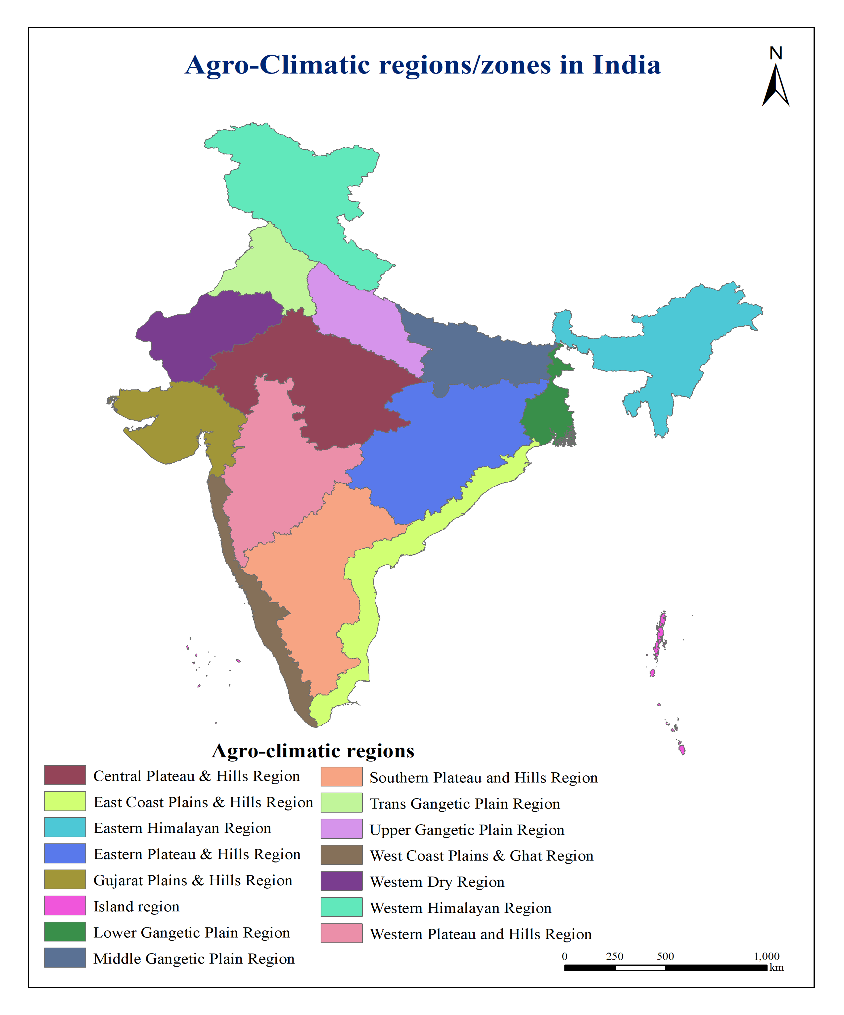
Created a thematic map illustrating India's agro-climatic regions based on climate, topography, soil, and vegetation characteristics. The map supports agricultural planning, crop suitability assessment, and regional resource management.
Study Area: India
Duration: Personal Learning Project (2025)
Role: Solo project
Status: Completed
Methods & Tools
Data Sources
- ESRI
- DivaGIS
Tools Used
- ArcMap
- Excel
Key Findings
- Mapped India's agro-climatic zones.
- Supported crop suitability assessment.
- Assisted regional agricultural planning.